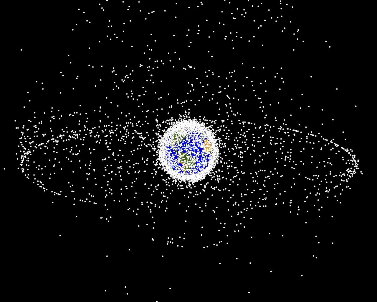
Debris plot by NASA. A computer-generated image of objects in Earth orbit that are currently being tracked. Approximately 95% of the objects in this illustration are orbital debris, i.e., not functional satellites. The dots represent the current location of each item. The orbital debris dots are scaled according to the image size of the graphic to optimize their visibility and are not scaled to Earth. The image provides a good visualization of where the greatest orbital debris populations exist. The two main debris fields are the ring of objects in geosynchronous Earth orbit (GEO) and the cloud of objects in low Earth orbit (LEO).
This image is generated from a distant oblique vantage point to provide a good view of the object population in the geosynchronous region (around 35,785 km altitude). Note the larger population of objects over the northern hemisphere is due mostly to Russian objects in high-inclination, high-eccentricity orbits.
![]() Don't forget to feed the birds. Donate here
Don't forget to feed the birds. Donate here